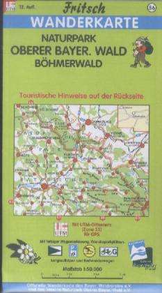
Naturpark Oberer Bayerischer Wald (Karten)
Naturpark Oberer Bayerischer Wald
Karten

Currently not available.
Let our eCourier notify you if the product can be ordered.
Let our eCourier notify you if the product can be ordered.
- Publisher:
- Fritsch Landkarten-Verlag, 09/2012
- ISBN-13:
- 9783861160564
- Copyright-Jahr:
- 2012
- Weight:
- 105 g
- Format:
- 227 x 130 mm
- Thickness:
- 13 mm
- Release date:
- 15.9.2012
Similar Articles


Blurb
Die Karte enthält den Naturpark Oberer Bayerischer Wald. Stellt Schönsee im Norden dar und reicht im Süden bis Roding, Bad Kötzting. Im Osten reicht die Karte bis Domazlice (Taus)/Nyrsko (Neuern) in der Tschech. Republik, Im Westen ist Rötz dargestellt..
Notes:
Please note that we are subject to price changes from our suppliers and must pass price increases or decreases on to you.